
CONSTRUCTION
Build clarity. Reduce rework. Tell the story of progress.
Reliable aerial visuals that improve safety, communication, and confidence across every phase of construction.
PROGRESS DOCUMENTATION
Showcase what makes your project remarkable.
Cinematic aerials that capture scale, emotion, and sense of place.
-
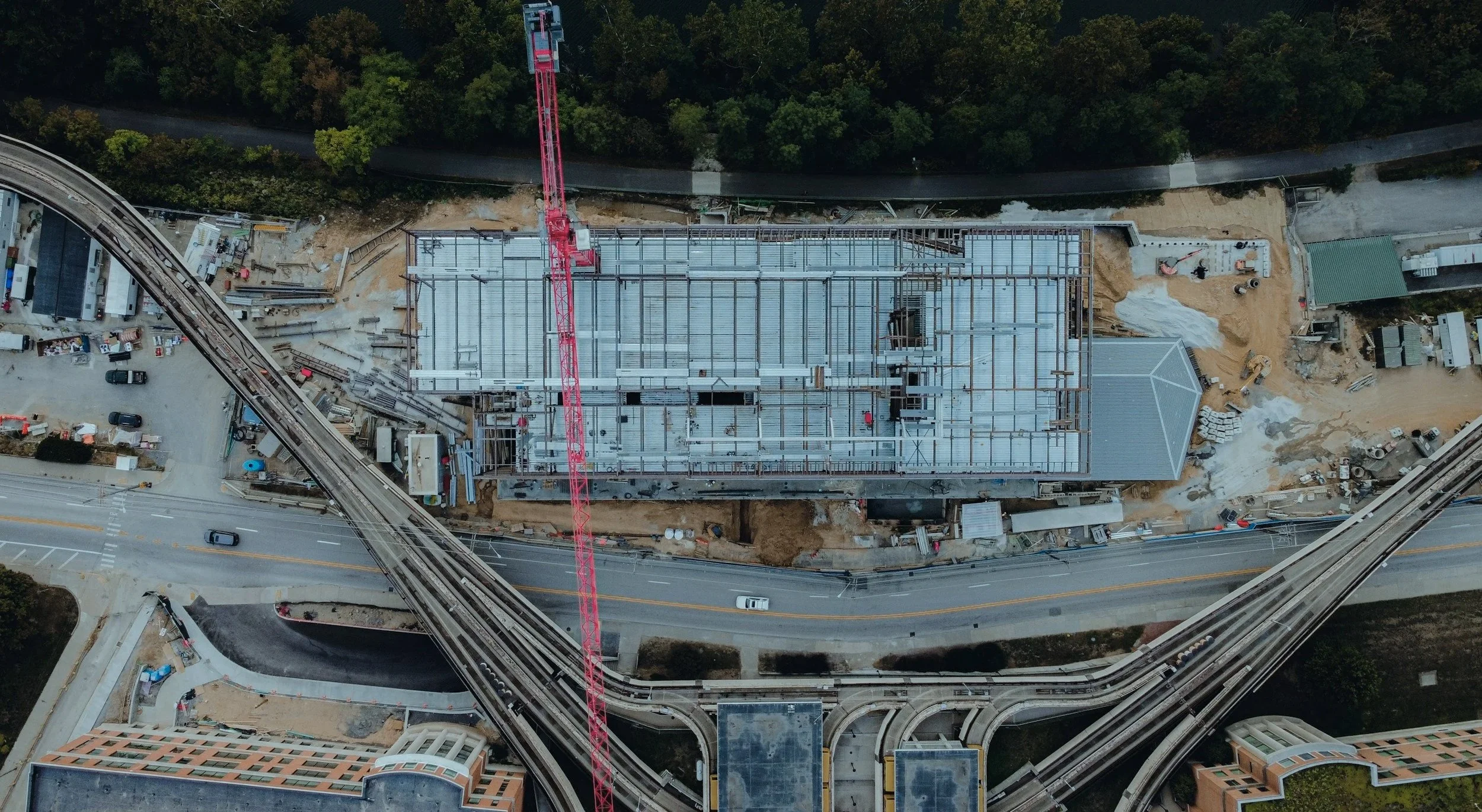
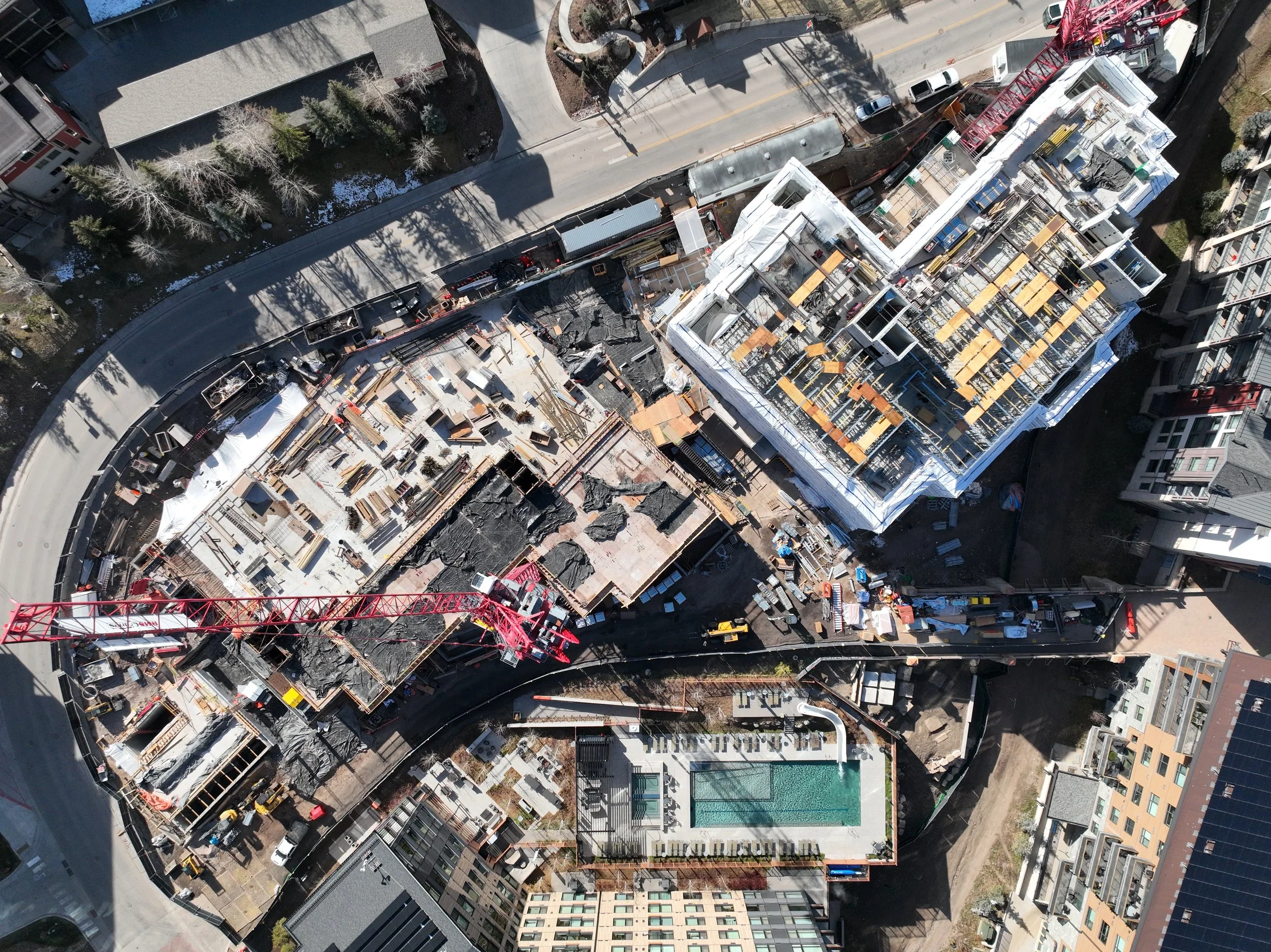
Consistent high resolution stills captured from fixed vantage points that create a visual timeline of progress. Highlight site logistics, material staging, and site organization with clarity ground photos can’t provide.
-
Show momentum in motion with cinematic aerial footage that documents active crews and evolving structures. Ideal for client updates, marketing reels, and stakeholder reports.
-
Turn months of work into a single compelling story. Our time-lapse footage reveals transformation over time and showcases milestones achieved with precision and pride.
-
Beyond simple snapshots, these curated images capture key phases of construction with consistency and artistry. A reliable record for reports, presentations, and executive updates.
-
Deliver actionable visuals. Our georeferenced imagery integrates directly into leading construction platforms for accurate planning, logistics, and project coordination.
-
Cinematic flyovers built for digital channels that highlight craftsmanship, progress, and scale. Perfect for portfolio pieces and brand storytelling.
-
Celebrate your team and equipment with dramatic aerial portraits that capture the people and machines behind every build. Great for recruitment, awards, and company showcases.
-
Provide polished aerial overviews tailored for high-stakes presentations. Give clients and investors a clear, confident view of where their project stands.
INSPECTIONS, COMPLIANCE, & SAFETY
Work safer and stay informed.
Aerial visibility that reduces risk and keeps every detail in view.
-
Inspect roofs, framing, scaffolding, and high-access areas safely from the air. Identify issues before they become risks or rework.
-
Capture detailed visuals of siding, windows, and façade installations to ensure alignment, placement, and finish quality.
-
Use aerial inspection to access hard-to-reach or unsafe areas without disrupting work or endangering crews.
-
Identify potential hazards and verify safety compliance from a distance. Keep teams secure while maintaining clear visual oversight of the job site.

SITE SURVEYING & MAPPING
See your site with unmatched clarity.
Accurate drone data that turns images into measurable insight.
-
Accurate top-down imagery stitched from high resolution drone captures to create detailed orthomosaic maps ready for integration into design and planning tools.
-
Generate precise 3D models of terrain, grading, and vertical structures to visualize elevations, slopes, and volumetrics with accuracy you can build on.
-
Compare current conditions against design intent using drone-based mapping. Identify alignment issues early and ensure every element is built to spec.
-
Use photogrammetry to measure stockpiles, verify grading, and spot discrepancies without setting foot on site. Save time and improve accuracy in every phase.

Contact Us
We’d love to learn more about your project. Share your email and some more information and we will reach out to you as soon as possible.